Historical and Archival Applications
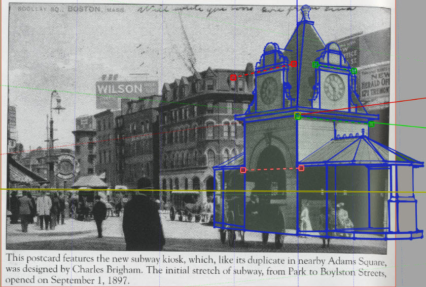
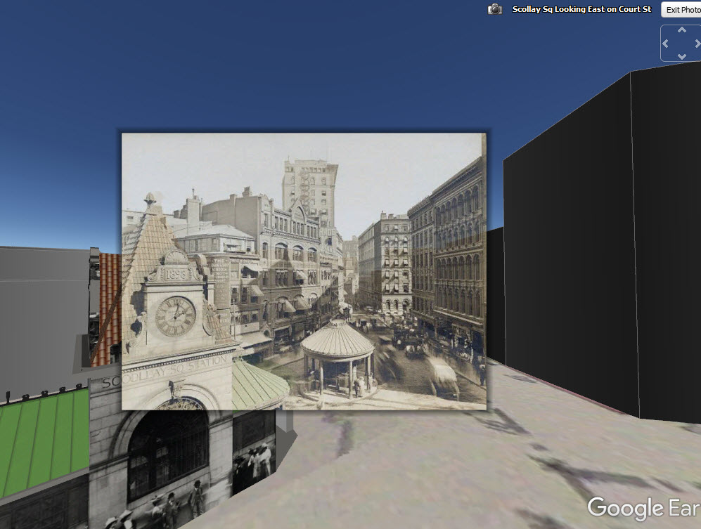
Scollay Square Subway Kiosk
Scollay Square Subway Kiosk
The Boston Planning and Development Agency (BPDA) maintains a 3D model of the city as a visualization and analytical tool for understanding ideas related to the future of neighborhoods. The BPDA shares the Boston 3D city model in several formats intended to facilitate collaboration between diverse communities who have an interest in understanding places in the city as they have changed or as they may be changed. Find an overview of the BPDA's city model sharing strategy in Boston 3D User Guide.
Preserving historical information may not be near the top of the priority list for administrative information managers; nevertheless, one of the measures of success for a 3D city model management plan will be whether assets that will be valuable for other city departments, such as libraries and historical commissions are preserved.
Libraries and historical commissions preserve information assets such as photographs of places and old maps and other documents. Tools like the Boston Public Library's Digital Commonwealth, and AtlasScope demonstrate how a libraries use georeferencing to leverage assets to stimulate historical curiosity and support historical research. In this context, we can think of 3D models of buildings and terrain models as digital assets similar to photographs and maps.
At the moment, there are not many people active in developing historical models of places that could help to understand meaningful historical situations such as the development of Scollay Square, Nubian Square, or Kendall Square. One reason that these studies don't exist is because of the huge barriers to getting started, like lack of an initial model and the absense of protocols for sharing and re-using work.
It is also likely to be the case that Librarians and other costodians of historical information are not spontaneously interested in collecting 3D models. The lack of ready-to-use repositories and preview tools for 3D models introduecs a giant cost, and there are plenty of other worthy projects to be working on. Most libraries have not even begun to collect two-dimensional GIS data. But that does not mean that the costodians of public data-sets should imagine that there is no imperitive to preserve the records of observations and proposals that may be of interest in the future. Just like unique antique photographs. Once the record is lost, ther ei no way to make the observations again.
The scheme for organizing, encoding and sharing city-model components described here may be one step toward the inevitable day when students download and develop historical 3D models as school projects, uploading them again for further development or exploration by others. We know that that day will come, once the resources and workflows have been demonstrated and after some further development of modeling, visualization and asset management tools.
The epoch when libraries are invloved in supporting historical city model culture may be five years off. Our current attention to the resources, tools and workflows releted to the contepmprary and future-oriented applications of city models will pave the way for cool demonstrations of city-models as historical tools.
Three dimensional relationships unlock new information about the context of teo-dimensional documents.
In the mean-time as we are designing the next stage for city-model sharing and re-use, we ought to consult with the city's librarians and archivists to see if they have any guidance. Here are a couple of questions we could ask.
- Treating 3D models as documents in a normal library repository will require a minimum of core metadata, recording the author and sources for each model. Are the attributes that we lay out on the Building Model Attributes (CSV) table sufficient?
- Are there projects in your institution that are beginning to look at the storage and catalogging of digital 3d models? Is there anyting we should learn from these?
- Is the BPDA library already involved in collecting GIS data? Is anyone systematically saving information related to Large Project Review?
- Should we add models of proposed projects to our export scheme?