Tiled JPEG Basemap
High resolution raster basemap.
File Name:
BOS3D_[Tile]_Basemap_2011.jpgFormat: JPEG
Updated: Most of the features were observed in 2011. Building footprints updated July 2020
Description
The Boston Planning and Development Agency (BPDA) maintains a 3D model of the city as a visualization and analytical tool for understanding ideas related to the future of neighborhoods. The BPDA shares the Boston 3D city model in several formats intended to facilitate collaboration between diverse communities who have an interest in understanding places in the city as they have changed or as they may be changed. Find an overview of the BPDA's city model sharing strategy in Boston 3D User Guide.
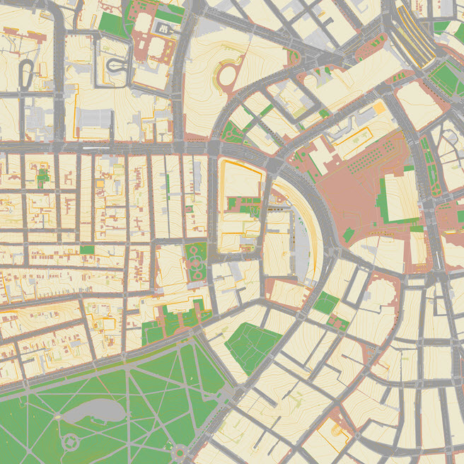
The 2010 Basemap layer provides a clear reference map showing the edge of paved and planted areas as well as labeled 1-foot contours, street names, pavement markings and parcel boundaries. In all, 24 layers from the Boston GIS were graphically ordered and styled and then clipped to each tile boundary. The original layers were developed from stereo photogrammetric methods, with a precision of about six inches. The cell size of the basemap layer is approximately 12 centimeters.
Purpose
These basemaps provide a visual reference for the ground condition as it relates to terrain and buildings. Eadh image is clipped to the same frame as the tiled terrain models so that it canbe easily draped onto the terrain to provide a reference for the location of 3D models.
Sources
These layers come from a variety of sources. Most of them are from the 2011 photogrametric survey by InfoTech. Buildng Model footprints are made from the Boston 3D Current 3D buildng Models. Property parcels (2017) are downloaded from Boston Open Data.
Coordinate System
Although these image files are not georeferenced, they are based on the same Massachusetts State Plan projection to match exactly with the other components of the BPDA's Boston 3D city model.
Usage Notes
- These images have extents that align precisely with the tile boundary included with all of the other data BOS3D files for easy registration. In sketchup, groundplan images may be easily applied the terrain. From the Materials Window, use the eye dropper to select the terrain material, then choose the desired ground plan image in the Edit tab. (See Screenshot)