Tiled Orthophoto 2020
File Name: BOS3D_Aerial_2014.jpg
Format: JPEG
Updated: Spring 2020
Description
The Boston Planning and Development Agency (BPDA) maintains a 3D model of the city as a visualization and analytical tool for understanding ideas related to the future of neighborhoods. The BPDA shares the Boston 3D city model in several formats intended to facilitate collaboration between diverse communities who have an interest in understanding places in the city as they have changed or as they may be changed. Find an overview of the BPDA's city model sharing strategy in Boston 3D User Guide.
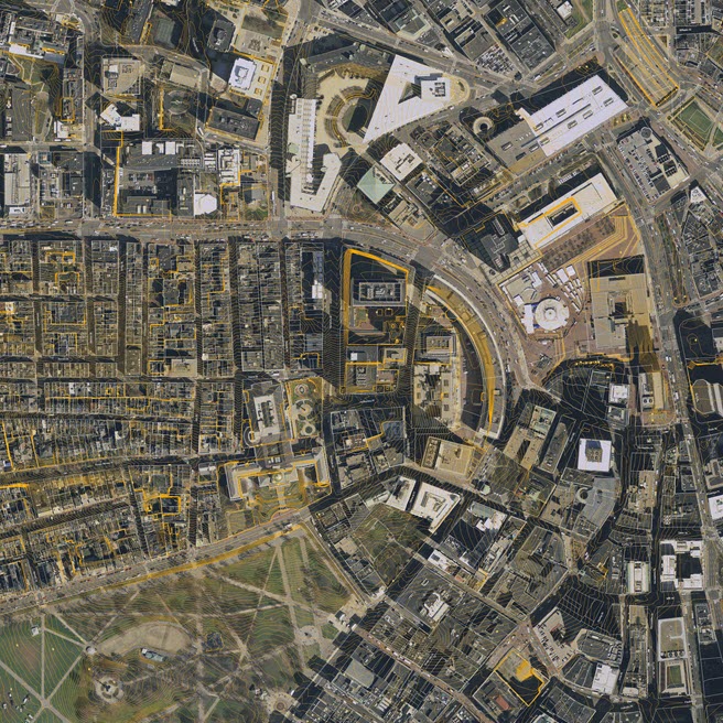
The tiled aerial photo layer is a true-color ortho-rectified aerial photo with a pixel resolution of one foot per pixel.
Purpose
This aerial photo is useful as a visual reference for the ground conditions as it relates to terrain and buildings. More recent than the 2011 planimetric groundplan, these photographs may be useful for discovering updated conditions or details not included in the vector-based planimetric groundplans. These images are included in lut Layerd PDF Base Maps. Because they are oriented and trimmed using our Bos3d Tile Grid, these images are very easy to drape onto the Boston 3D Tiled Terrain Models and the terrain component in our Boston 3D Tiled SketchUp Models (see usage note below).
Sources
Made from a spring 2020 photogrammtric survey.
Usage Notes
- Being clipped exactly to the frame for each tile of the city-wide grid, these images are very easy to register and apply as a material on tiled terrain models.
- These aerials are included with the Layered PDF Basemap Tiles which may be a useful resource for people who want to update the 2011 groundplan image.
- To drape this image on the terrain in SketchUp, use the eye dropper in the Materials window to select the terrain material, then, using the Material Edit tab, use the browse button to find the apropriate image file. (See Screenshot)